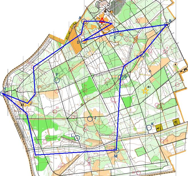
| A |
Bouncing Bombs (Small clearing. ) |
18:46:05 |
50 |
| 04 |
Small clearing, north side. |
18:51:36 |
5 |
| 10 |
Clearing. |
19:12:51 |
20 |
| 17 |
Gully crossing. |
19:19:23 |
20 |
| B2 |
Path junction. |
19:27:06 |
0 |
| H |
The Climb (Disused railway bridge. ) |
19:38:45 |
50 |
| 21 |
By earthwall. |
19:48:02 |
15 |
| 27 |
Small dip in ground (depression). |
20:01:58 |
30 |
| M |
Bounce Back (Path junction. ) |
20:34:29 |
50 |
| G |
Goaaaaaaal! (Rough ground north of forest road. ) |
21:29:18 |
50 |
| 09 |
Road/path junction. |
21:42:03 |
10 |
| E |
Inflation (By track junction. ) |
21:59:37 |
50 |
| B |
Big Bungee (Beside forest road. ) |
22:20:56 |
50 |
| C |
Child's Play (Playground south of forest road. ) |
22:58:16 |
50 |
| D |
Castle Seige! (Forest clearing. ) |
23:29:21 |
50 |
| 03 |
Top of spider?s web. |
00:10:15 |
5 |